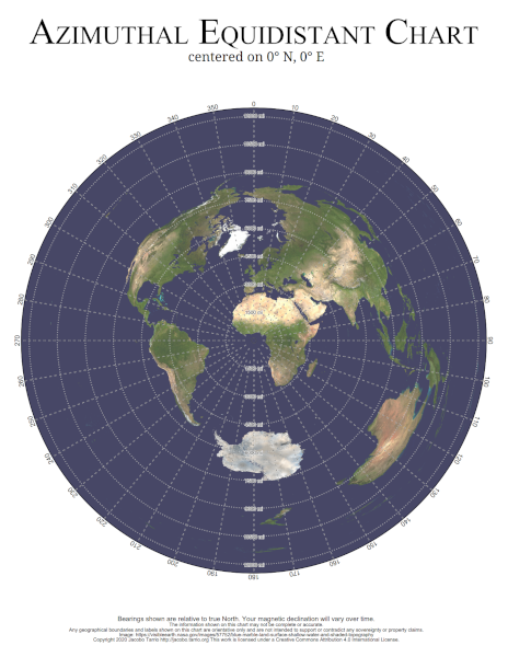
This web site, brought to you by Jacobo Tarrío, lets you generate an azimuthal equidistant chart centered on any location of Earth.
Those charts show you in which direction and how far every other point on Earth is. With one of these charts, a radio amateur can easily point a directional antenna to very far away locations.
You can use, share, and modify the charts generated by this website under the terms of the Creative Commons Attribution 4.0 International License. The base Earth image comes from NASA's Visible Earth collection.